

Globe Viewer Mars
GlobeViewer Mars is an interactive and three-dimensional globe of the entire surface of Mars. The 3D global map shows all official designations for various surface features. If you are interested in a specific region, an even higher resolution local 3D map view can be loaded for a closer look at the craters, mountains and other formations in 3D. In addition, a mission log of all Mars missions since 1960 has been included.

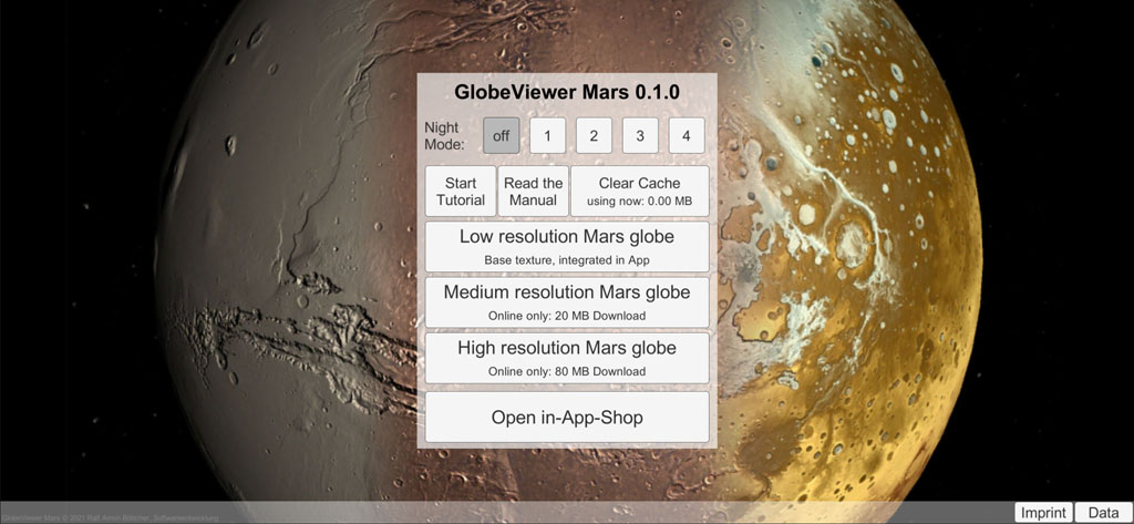
Install Globe Viewer Mars
Download the Globe Viewer Mars app here:
| Free demo version | payable PRO-Version | |
| Apple iOS and MacOS: | ||
| Google Android: | ||
| Microsoft Windows Store: |
The free demo version is aimed at private users - via the integrated shop you can only switch off the advertising by purchasing NoAds for a small price or you can purchase the complete PRO version, which gives you access to all regional 3D maps. Server connections to advertising networks and to the respective Google, Apple or Microsoft store are required for these options. If you have activated NoAds or Pro, there is no need to contact the advertising service.
The payable version is intended for use in schools, which can receive a discount for multiple orders via the volume purchase (i.e. buys licenses for a school class) - this is not yet possible with in-app purchases. Since neither the advertising part nor the in-app shop part is activated by the code in the purchase version, the purchase version is the more data protection-friendly variant, since no contact is generally established with the corresponding online services and servers. If this data protection aspect is important to private users, they can also use the purchase version instead of using the free demo app purchasing in-App-purchases in the integrated shop - the content of both PRO versions is identical.
Manuals
Manuals are available in the following languages: DE, EN, FR, IT, ES, PT, AR, CHS, CHT, FA, HE, HI, ID, JP, KR, RU, VN and TH.
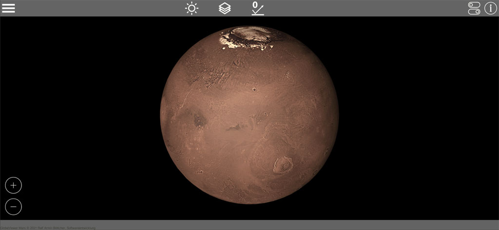
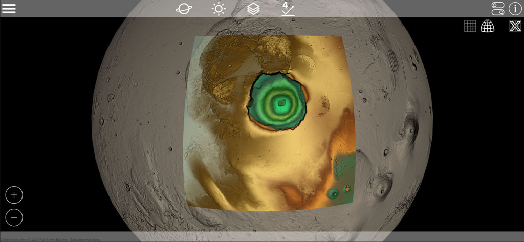
Global Mars Maps
Four map modes are available (elevation display, photo display, a combination of both and the gray color mode). In addition, surface details (normal maps) have been obtained from the elevation data for the display, which can be combined with all map modes. Even the smallest craters, elevations, grooves and gorges are visible on the map.

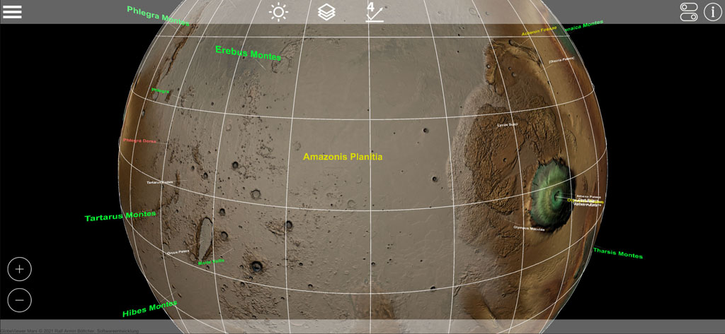
Map display and designations
The icons in the upper right corner allow you to customize the map display and which formations on the globe should be shown with names. The info symbol opens the available detailed information on the formations and allows you to search for parts of the name. Zooming in closer to the globe also shows the names of smaller formations.

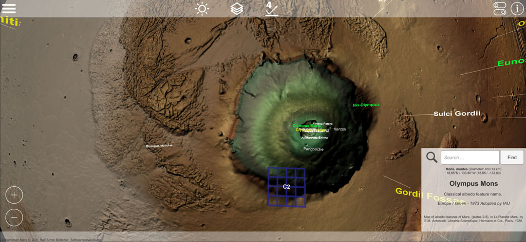
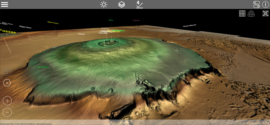
Local 3D Mars Maps
The local maps show a certain area with a much higher resolution and above all as a real 3D model. Explore the well-known formations from all directions. Here, too, you can switch the texture to the 4 different map modes, e.g. to get a better impression of the height differences.

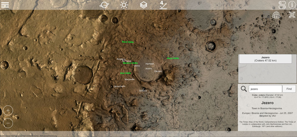
NASA Mission M2020 map
Since version 0.4 we show the landing region of NASA's Mars2020 mission. The extra high-resolution landing site map was generated using HiRISE data from the Mars Global Observer. Here you can see the rover's surroundings in Jezero Crater. In addition, you can increase the heights in the 3D map to get an even better impression of the height gradients. The map shows the movements of the Perceverance rover and the Ingenuity helicopter, so you can follow the current mission progress on this map.

New: 3D details of the M2020 NASA mission
New in version 0.7 are impressive detail views created from Percy and Ingy's photos using photogrammetry. Look at the stones and rock formations as if you are right there on Mars! These great detailed views have been integrated into the M2020 history list.

There are over 40 of these details available. Open the mission list at the bottom left. There you can click Details next to the route history of Perceverance and Ingenuity. Now slide the slider to the desired mission day. A magnifying glass shows the position of the detail or the position of the rover for that day. The button takes you to the detailed view.

We hope you enjoy exploring the Jezero Crater virtually.
Lighting
The lighting in the 3D map view is designed in such a way that the light can be directed into the craters from all directions. This serves to improve the visibility of height structures and is not intended to represent the real lighting situation. Also in the globe view, a realistic lighting, which includes the ecliptic, was omitted in favor of the visibility of the polar regions.
Feedback
The app will receive regular updates in the future - this way user feedback should feed into further development. If you have any suggestions or ideas for more features in the app, please just contact us via the contact form on our website. We are looking forward to your feedback.
{gallery}artikel/projekte/globe_mars,width=160,height=100,limit=1,limit_quantity=8,gap_v=30,random=2,column_quantity=10{/gallery}


Reviews
- Blog "Exploring astronomy & space apps and Google" von
- "These incredible works are the best planetary globes for Android."
- "The Moon and Mars look gorgeous in GlobeViewer Moon and GlobeViewer Mars. I’m spending more and more time playing with the apps to explore these worlds. Mind-blowing."
